
A navigation-satellite launch can sound like a phone update: a new satellite goes up, so every map should immediately work better. The connection is less direct. To benefit from NavIC, a device needs the appropriate receiver capability and implementation, while the navigation system itself must supply usable signals.
The practical answer: NVS-03 is a spacecraft addition, not a software download for all handsets. Check the exact device specification and the evidence of signal use before making a claim about your own phone.
Follow the signal through three different layers
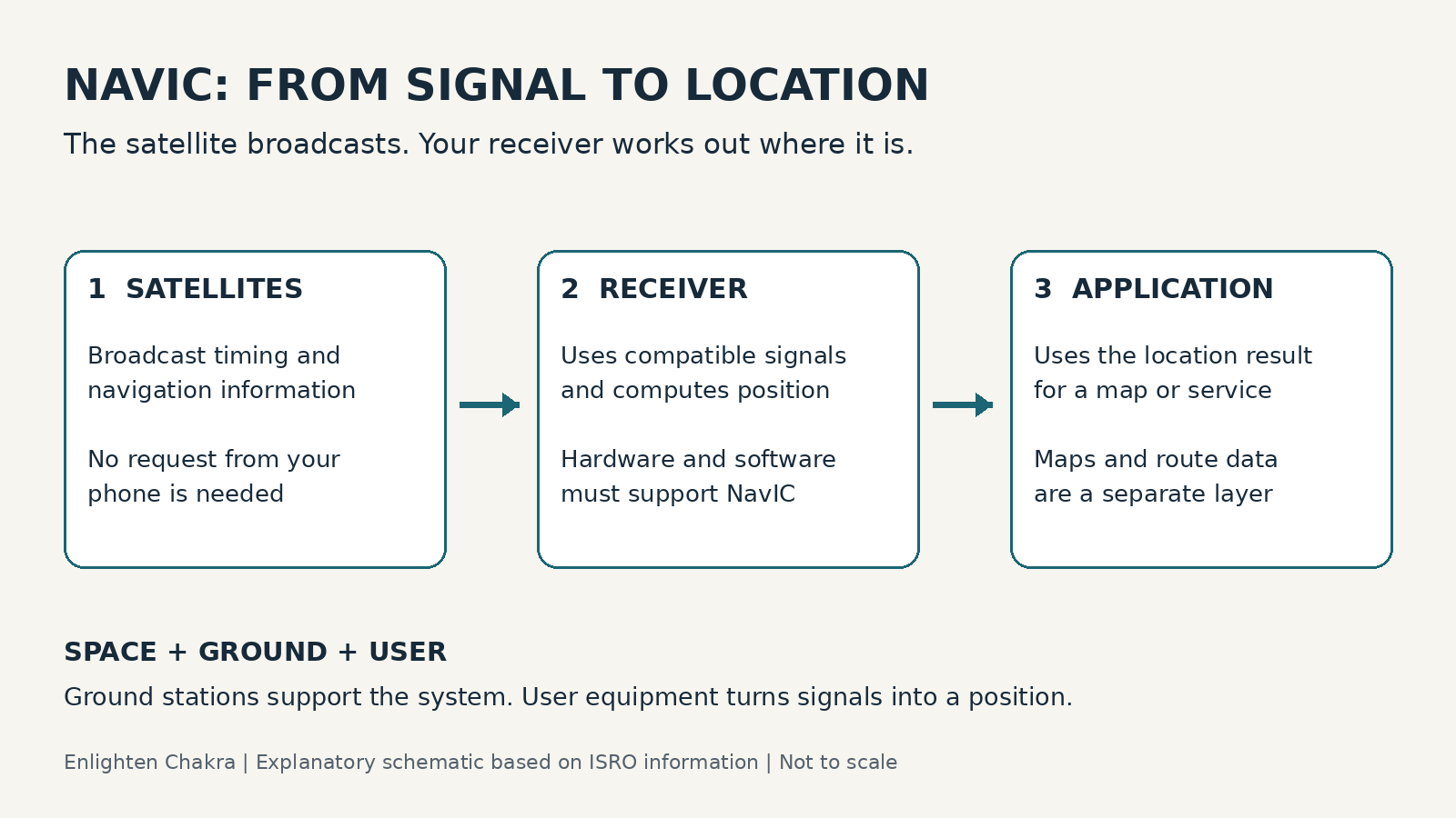
ISRO’s NavIC explanation separates the system into space, ground and user segments. Satellites broadcast navigation information; the ground network supports the system; compatible receivers use the signals to compute a position and time. An application then uses a location result. The original schematic above illustrates these roles; it is not a map of the constellation.
That separation helps you ask a more precise question. “Does this phone support NavIC?” concerns the user equipment. “Has NVS-03 completed its checks?” concerns the spacecraft and system. “Why is this road missing?” may concern the map data. A single launch announcement cannot answer all three.
What L1 support does—and does not—tell you
The NVS-03 mission page highlights an L1 signal alongside L5 and S. ISRO’s services overview identifies NavIC’s civilian L1 signal at 1575.42 MHz and describes interoperability with other navigation systems. But sharing a frequency band does not establish that a receiver implements every system’s signal on that band.
Read the device maker’s specification for an explicit NavIC or IRNSS entry. Where available, check the supported bands and the exact model variant. A statement about a chipset family is useful background, but the finished handset is the product you will actually use.
| Claim you may see | What it establishes | What to check next |
|---|---|---|
| “GNSS supported” | A general satellite-navigation capability | Which constellations are named? |
| “NavIC/IRNSS supported” | An explicit device capability claim | Which model, bands and software version? |
| A receiver app lists a satellite | It may be visible to the receiver | Does the diagnostic distinguish tracked from used in the position solution? |
| A map shows your location | The app has a location estimate | Which sources contributed to that estimate? |
The satellite does not need a request from your phone
ISRO explains that navigation signals are broadcast to users within coverage. A compatible receiver listens; it does not reserve an individual connection to the navigation satellite. The GPS.gov system overview describes the same broad distinction between one-way satellite signals and receiver calculations for GPS.
This is why a navigation fix and downloading map content are different tasks. An app may need internet access for maps, search or live traffic even when its receiver can obtain satellite signals. Conversely, seeing a location dot is not proof that NavIC alone produced it.
How to check without overclaiming
Begin with the manufacturer’s documentation for the exact device. If you use a receiver-diagnostic app, read its explanation of labels and icons rather than assuming a coloured dot means a signal is contributing to the fix. Test in a permitted open area with a clear sky view and record the device and software details.
Do not infer an improvement from one screenshot before and one after a launch. The observing conditions, visible satellites and receiver behaviour may differ. If you want a meaningful comparison, keep the conditions as similar as possible and distinguish a casual observation from a measured performance test.
What remains useful even if your phone lacks support
ISRO’s applications FAQ describes uses across transport, surveying and other positioning tasks, and explains that an appropriate receiver is needed. NavIC is infrastructure used by more than consumer map applications. Its value cannot be judged only by whether one person’s current phone lists it.
For a purchase decision, prioritise the navigation behaviour you actually need and verify the device’s stated capabilities. Avoid buying a new handset solely because a launch headline promises an automatic accuracy gain. Product support and real-world performance need product-specific evidence.
Launch background: GSLV-F18 and NVS-03: the 30 October mission, the rocket and the transfer orbit.
Sources checked 31 October 2026: ISRO: NavIC and GNSS · NVS-03 mission · NavIC signals and services · Receiver and application FAQ · GPS system segments. Some ISRO FAQ passages include older device-market examples; this article does not use those as a current handset count. The checklist is editorial guidance, not a hands-on review of a named device.
Leave a Reply